B Ride
Alto Velo’s B Ride is a challenging but fun Saturday ride focused on community, good routes, and great company, bringing together riders with a wide range of abilities and experience. Rides are designed to be rewarding but approachable, with most routes around 50 miles and a focus on keeping the group together. The focus is on riding together rather than racing. The B Ride follows Alto Velo’s Ride Rules, and all participants are asked to sign an annual waiver.
Start: Saturdays at 9:00am from Summit Bicycles (392 California Ave, Palo Alto), rolling out at 9:10am. New riders are always welcome—come say hello and join the group.
Pace: Generally moderate, with stretches that can pick up. If you’re riding near the front early on, please help keep things cohesive by checking in on the group behind you—we ride as one group, not a string of individuals. Climbs are usually ridden at a vigorous pace and we always regroup at the top.
Regroups: We make a point to come back together at the tops and bottoms of hills, taking time to recover after climbs so everyone can stay together.
Example route:https://www.strava.com/routes/4519225
See below for details on upcoming rides and a look at where we’ve been.
AV-B Ride Jul 25th: Kings, Skyline, 92, Cañada
AV-Ber’s,
This Saturday we will roll out through Woodside to tackle our main ascent for the day: the shaded and winding Kings Mountain Road. After regrouping at the summit, we'll cruise north along the Skyline ridge before taking the fast descent down Highway 92. From there, it's a flatter, paceline-friendly stretch heading south on Cañada Road.
As always, we will maintain a steady B-ride pace on the flats and ensure everyone regroups after the major climbing efforts so the group stays together. We will finish with a well-deserved post-ride burger and shake run at Shake Shack!
Non-members are always welcome, but please complete the waiver once a year.
Please make sure to familiarize yourself with the ride rules as well.
Ride Leader: Nicolas Delecroix
Start / End Location: Start at Summit Bicycles, California Ave, end at Shake Shack Stanford Shopping Center
Route: 48 miles / 3,600 ft
Route file: https://connect.garmin.com/app/course/491480114
Start Time: Meet: 9 AM, Leave: 9:10 AM
Regroups:
Top of Kings Mountain
Pulgas Water Temple (Water, Restrooms)
AV-B Ride July 18th: Bike Hut Classic, Popsicles, Pizza!
AV-Ber’s,
It’s going to be a fun one with rewards for your hard effort up Tunitas this weekend!
First of all, the heat will be gone by Saturday so we can all breathe a sigh of relief for that! We will take Sand Hill to Old La Honda where I will be spinning a very leisurely Zone 2 pace to save my legs for Tunitas. We will regroup at Sky Londa but keep it brief so we can enjoy longer breaks later! After descending all the way down 84 we will do a quick regroup at the San Gregorio General Store and then I will be used the 1-mile Stage Road climb up to Hwy 1 as my warm-up for the Tunitas effort! After descending Hwy 1 we will regroup AT The Bike Hut!
It is of course the final weekend of The Bike Hut Classic and if you haven’t checked out their website yet please do that! Consider donating to help them out because we ALL love The Bike Hut and 100% of donations helps out their farm, the local homeless community, and low-income families. The segment will trek up in honor of this starts at The Bike Hut and climbs all the way to Skyline. We can get a good draft going on the bottom section and once it gets steep I’m sure we’ll all go at our own paces. Waiting at Skyline for us will be Moss + Wonder again and the club has already prepaid for us all to enjoy a delicious popsicle as a reward for giving Tunitas everything we could! But that’s not all… we’ll then descend Kings Mountain Road and take Whiskey / Sand Hill back to Peers Park for PIZZA!!!
This weekend, Katie, Alto Velo member and founder of Nastro, will be sponsoring pizza for all of us to enjoy while we hang out post-ride! Nastro is a local community project born from a passion for bringing people together. Nastro helps you find others nearby to grab coffee, go for a hike, play pickleball, walk your dog, or do whatever you're in the mood for with people you already know through communities like Alto Velo! Join the Alto Velo community by clicking here!
After this disgusting heat wave I’m super excited to see everyone this weekend! I’m not feeling in the best shape to attack the Tunitas climb myself. But let’s give it what we have in the tank together, eh?! We get fancy popsicles and pizza afterwards for crying out loud! See you there!
Non-members are always welcome, but please complete the waiver once a year.
Please make sure to familiarize yourself with the ride rules as well.
Ride Leader: Kessler
Start / End Location: Start and end at Summit Bicycles, 392 California Street, Palo Alto, CA
Route: 54 miles and 5,100 feet
Route File: Link to Strava Route File
Start Time: Meet: 9 AM, Leave: 9:10 AM
Regroups:
Mile 13.3 - Regroup at Skyline (water/bathroom)
Mile 27.7 - Quick Regroup at San Gregorio General Store
Mile 31.3 - Regroup at The Bike Hut (water/porto)
Mile 39.5 - Regroup at Skyline (Popsicles!)
Mile 54 - Ride End at Peers Park (Hang out and thank Katie for Pizza!)
AV-B Ride July 4th: Pescadero, Bike Hut Classic, Pizza!
AV-Ber’s,
This week we are heading to the coast to celebrate several of the area’s cycling traditions and finishing it off with the best tradition of all - free food!
The route is the Pescadero variant of the coastal classic route. After climbing OLH instead of taking 84 all the way to Stage Road, we’ll turn left at Pescadero Creek Road and go over Haskins Hill into Pescadero then take Stage back to Hwy 1 and the Bike Hut. We’ll end the ride in Peer’s Park with free pizza supplied by our sponsor Alpine Haus Construction.
This route covers a good portion of the race course for next week’s Pescadero Road Race. If you’re racing, this is a good opportunity to have a look at the race’s significant climbs and descents. If not, please volunteer by clicking HERE if possible and then ask a friend to do so as well. This is a special and unique local event and is only possible thanks to many volunteers from our club and the local community.
We will also be riding the Bike Hut Classic segment from the Bike Hut to the top of Tunitas. This event supports the local community in an area that we all regularly enjoy. I’ll be on domestique duty this ride and will bring a bag to carry excess ballast for anyone making an effort at the segment. We’ll also try to get organized into groups at the Bike Hut based on target times as the first few miles (and last few) are excellent for drafting. Right now the forecast is promising for a good effort - moderate temperature, possible tailwind from the coast, and a good chance of popsicles at the top of the climb to cool us down.
This Saturday post ride is sponsored by Alpine Haus Construction, a Bay Area residential general contractor specializing in home remodels, kitchen remodels, ADU, home additions, and bathroom renovations. Whether you're planning a bathroom renovation or a modern kitchen remodel, Alpine Haus brings the same discipline and attention to detail to every project that we bring to every ride. Check out their work at www.alpinehaus.construction.
Non-members are always welcome, but please complete the waiver once a year.
Please make sure to familiarize yourself with the ride rules as well.
Ride Leader: James R
Start / End Location: Start and end at Summit Bicycles, 392 California Street, Palo Alto, CA
Route: 68 mi, 6,600 ft / 109 km, 2000 m
Route File: https://www.strava.com/routes/3507554145189050374
Start Time: Meet: 9 AM, Leave: 9:10 AM
Regroups:
Alpine & Portola
Skylonda (Water, Restrooms)
Bottom of Haskins
Pescadero (Water, Restrooms, Food)
Bike Hut (Water, Restrooms)
Top of Tunitas (Popsicles?!)
Old Woodside Store (Water)
AV-B Ride June 27th: Page Mill, WOLH, Jefferson, THE SHACK
AV-Ber’s,
It’s Shake Shack weekend!
This week’s ride takes us to burgers. But before burgers we will Page Mill and regroup at the top. After descending Alpine West we’ll do a quick regroup at Pescadero Road. Then we’ll go up 84 and West Old La Honda and regroup at Sky Londa. After that we descend and head to Edgewood Road and we’ll do a quick regroup at Cordilleras after the short climb and descent. This keeps us together as we navigate residential roads to our last climb, Jefferson! After regrouping at the top we can hightail it to BURGERS AND FREE SHAKES!
Non-members are always welcome, but please complete the waiver once a year.
Please make sure to familiarize yourself with the ride rules as well.
Ride Leader: Kessler
Start / End Location: Start and end at Summit Bicycles, 392 California Street, Palo Alto, CA
Route: 54 miles and 5,400 feet
Route File: Link to RideWithGPS Route File
Start Time: Meet: 9 AM, Leave: 9:10 AM
Regroups:
Mile 13.8 - Regroup at Skyline
Mile 21.2 - Quick Regroup at Pesadero
Mile 31 - Regroup at Sky Londa
Mile 41.3 - Quick Regroup at Cordilleras Rd
Mile 45 - Regroup at Top of Jefferson
Mile 54 - Shake Shack
AV-B Ride June 20: Montebello + Everest support
Hello AV-Ber's,
This week’s ride will head South to show some support to regular B-ride leader Kessler as he attempts to Everest on Highway 9!
Beginning with a steady roll down foothill, we’ll warm up (and give the A-ride a head start) with the climb of Montebello. After regrouping at the top and (carefully) descending, we’ll make a water stop at the Canyon picnic area and then head over Eden and Pierce before turning right onto 9. At some point between Sanborn and Redwood Gulch, we’ll expect to see Kessler: anyone who wants to make a buddy lap to cheer on his attempt is highly encouraged! The next regroup and water stop will be at the fire station on Skyline: turn right at the top of 9, and it’s around half a mile on the left. We’ll take enough time there for all the loyal supporters to arrive. We’ll then head North on Skyline, make a quick regoup at the top of Page, and descend for home.
Bring your cowbells!
Ride Leader: Henry
Start / End Location: Summit Bicycles
Time: Gather @ 9:00 AM, Roll @ 9:10 AM
Road Route: https://www.strava.com/routes/3503121162155347060
85 km (53 miles) & 1,900m (6,200 ft)
Regroup Points:
Top of Montebello
Canyon picnic area
Saratoga summit fire station
Top of Page
________________________________________________
The AV B Ride is subject to Alto Velo's Ride Rules (read them!).
Non - Members:
Alto Velo welcomes non-members to join us on our rides. However, non-members must have a Waiver on file with the club.
AV-B Ride June 13: Pesky 84
Hello AV-Ber's,
It's been a hot one this week, but hopefully we can find some cooler temps on the west side of Skyline.
We'll be climbing up OLH and then making the traditional stop at Skylonda for water. From there, we'll descend 84 all the way to San Gregorio. We will regroup briefly in La Honda to make sure we're all together for the second half of it! At San Gregorio, we'll take a left on Stage Rd and make our way to Pescadero for a proper coffee stop at Downtown Local. After that much deserved stop, we'll make our way back east via Pescadero Creek over Haskins Hill. After regrouping at the La Honda market, we'll embark on the final push back up 84 and WOLH to Skylonda before descending 84 to home.
Feel free to wind it up on the climbs, but lets keep the group together elsewhere. Family means no one gets left behind!
Hope to see you all out there!
Ride Leader: (other)Jonathan
Start / End Location: Summit Bicycles
Time: Gather @ 9:00 AM, Roll @ 9:10 AM
Road Route: Pesky 84
69 mi & 6,000 ft
Regroup Points:
Skylonda
La Honda (Quick re-group)
San Gregorio (Quick re-group)
Pescadero: Coffee Stop @ Downtown Local
La Honda Market
Skylonda
________________________________________________
The AV B Ride is subject to Alto Velo's Ride Rules (read them!).
Non - Members:
Alto Velo welcomes non-members to join us on our rides. However, non-members must have a Waiver on file with the club.
AV-B Ride June 6th: Manresa via Kings, Hillsborough and Joaquin
AV-Ber’s,
It’s time for some delicious Manresa pastries again, generously provided by our sponsor, Bicycle Law. To work up an appetite, we’re going to climb a few hills first though, starting with Kings. We’ll then make our way along Skyline, descend eastbound on 92, and head North towards Hillsborough. After looping around Crystal Springs and Polhemus Rd, we’ll then drop down Crestview, which is steep enough to keep things interesting and confirm that your brakes are not merely decorative. Finally we’ll tackle Alpine Rd and, saving the best for last, Joaquin. Hope to see you there!
Non-members are always welcome, but please complete the waiver once a year.
Please make sure to familiarize yourself with the ride rules as well.
Ride Leader: Kessler
Start / End Location: Start at Summit Bicycles,Palo Alto / End at Manresa Bread
Route: 63 miles and 6,100 feet, Link to Strava Route File
Start Time: Meet: 9 AM, Leave: 9:10 AM
Regroups:
Mile 15 - Top of Kings
Mile 25 - Sawyer Camp Trailhead
Mile 34 - Water Dog Trailhead
Mile 48 - Portola Valley Town Center
Mile 52 - Top of Joaquin
AV-B Ride May 30th: OLH - West Alpine - Shake Shack
Bonjour / Hi AVBers!
The weather is looking fantastic this weekend, and we’re celebrating the end of May with one of my favorite routes. Come join me for my first-ever ride lead!
We’ll head up OLH first, regroup at Skylonda, descend 84, then climb West Alpine. We’ll finish via Page Mill and end at Shake Shack. As always, anyone who wants to send it up the climbs should feel free to do so, for the rest of us who like to chit chat, the pace will be around ~3W/kg.
The forecast looks clear, so I can almost guarantee great views and plenty of sunshine on West Alpine. What I can certainly guarantee is a Shake Shack treat waiting for you at the end of the ride.
Excited to see everyone!
Ride Leader: Sandrine (Sandy)
Start / End Location: Start at Summit Bicycles, 392 California Street, Palo Alto, CA / End at Shake Shack, Stanford Shopping Center
Route stats: 44 miles (72km) / 4,500 ft (1,370m) elevation
Route file: https://www.strava.com/routes/3494446155584689876
Start Time: Meet at 9 AM, leave at 9:10 AM
Regroups / stops:
Skylonda (water and restroom stop)
Fire station at the bottom of 84 (short regroup)
Top of West Alpine / Skyline (stop, restroom available but no water)
Bottom of Page (short regroup)
Shake Shack!
Pace: ~3 W/kg on the climbs, please be safe on the descents
Non-members are always welcome, but please complete the waiver once a year.
Please make sure to familiarize yourself with the ride rules as well.
AV-B Ride May 23rd: Early B-line to Pancakes
AV-Bers,
It’s time once again to wake up early and smell the pancakes. We will be heading to the South Skyline Fire Station for their annual pancake breakfast fundraiser. We’ll head out through the hills to take Moody into the Page Mill climb. We’ll regroup at the top of the climb then go south on Skyline to the fire station and an extended breakfast stop. It’s $10 for all you can eat pancakes with real maple syrup and sides (cash would be prudent). Once we’ve all had our fill we will put those pancakes to work descending Highway 9. We’ll turn off at Pierce and climb the back side of Eden. The last regroup will be at the water and restrooms at the bottom of Mount Eden road; then we’ll take Foothill back to the start.
Note that this ride has an early rollout time of 8:25. This is important so that get to the fire station before the C ride while the pancakes are still hot.
Non-members are always welcome, but please complete the waiver once a year.
Please make sure to familiarize yourself with the ride rules as well.
Ride Leader: James R
Start / End Location: Start and end at Summit Bicycles, 392 California Street, Palo Alto, CA
Route: 45 mi / 4,500 feet
Route File: Page Mill Pancakes to 9
Start Time: Meet: 8:20 AM, Leave: 8:25 AM
Regroups:
Mile 16: Page Mill and Skyline
Mile 22: South Skyline Fire Station
Mile 32: Canyon Picnic Area
AV-B Ride May 16th: San Franciso to Mill Valley, Hwy 1 to Bofax to Mt Tam
AV-Ber’s,
THIS RIDE WILL START AT THE GOLDEN GATE BRIDGE IN SF!
Now that everyone knows what’s going on… Lol Hope everyone is psyched for an all-time route in the North Bay! We will meet at the Welcome Plaza in SF at 9, usual time, and roll shortly after. If we get a big group up there I may ask some of you to ride across the bridge a few minutes early and wait for us on the other side so we aren't crowding the path. We will roll past Sausalito, down the bike path, through Mill Valley, and regroup after the Four Corners climb (shorter than Old La Honda).
We get to descend a super fun, super twisty section of Highway 1, climb over Muir Beach, and then roll in and out of coves and across cliffs overlooking the ocean. If you haven’t ridden this in awhile, it’s the stuff dreams are made of. Chef’s kiss. And then we’ll coffee and pastry stop in Stinson Beach. After that we get some flats to digest and settle in before a LOT of climbing. Bofax is first. Very consistent and moderate angle. Think Highway 9 but much twistier so no crazy fast cars. We’ll regroup at the top and then immediately roll in to Seven Sisters. There are several shorter climbs here but I can’t remember how many? And finally make our way across the ridge to the wall guarding the parking lot at the very top. Should be clear skies by then so the views of the ocean across Seven Sisters and of the City at the top should be amazeballs.
We’ll descend Pantoll and Highway 1 and regroup at the bottom quickly before making our way back to the bridge. Remember there’s still a short climb from Sausalito left! Once we get back to the bridge I WILL BE ADDING HAWK HILL before returning to SF. If anyone would like to join me and snap that photo everyone loves so much I would love the company. The loop up Hawk Hill then down the backside and returning through the Bunker Road tunnel adds 8 miles and 1,000 feet to the ride! Doing it at the end so anyone can join or skip it and you’re already at the bridge to head home.
The Crissy Field East Beach Parking Lot is free all day and has bathrooms that are usually cleaned first thing in the morning. They are 2 miles or less from the start location of the ride! And the weather is looking like 60ish to start and 70 at most to finish. Could still be a bit foggy/moist on the coast so a long sleeve may not be a bad idea. Very excited to see everyone and take in some world class views with you all!
Non-members are always welcome, but please complete the waiver once a year.
Please make sure to familiarize yourself with the ride rules as well.
Ride Leader
Start / End Location
Start and end at Golden Gate Bridge Welcome Center Golden Gate Bridge Plaza, San Francisco, CA 94129
Route File
60 miles and 6,000 feet
Start Time
Meet: 9 AM
Leave: 9:10 AM
Regroups
Mile 2 - Scoop remaining riders on north side of GGB
Mile 12 - Top of Sequoia Valley Road Regroup
Mile 22 - Coffee/Pastry stop at Parkside Cafe in Stinson Beach
Mile 31 - Top of Bolinas-Fairfax Road Regroup
Mile 37 - Top of Mt Tam East Peak bathroom/water stop
Mile 49 - Regroup at 7/11 after descent
AV-B Ride May 9th: Moody, Page Mill, WOLH, and Manresa
AV-Ber’s, it’s time!
After the freezing downpour we had on my last ride, I now declare and guarantee a NO RAIN RIDE! All bad weather gear should be left at home as we enjoy a pleasant, sunny ride (or your money back)*
This week we’re going to ride up Moody and Page Mill, then descend Alpine to make our way to La Honda. After that, we’ll ascend 84 for a moment before turning onto West Old La Honda. From the top of WOLH, we’ll make our way to Skylonda and descend 84 before we make our final stop at Manresa Bread.
Speaking of Manresa Bread, this ride has been sponsored by Bicycle Law. They are a law firm specializing in litigation on behalf of cyclists. If you are injured as a result of a hostile driver, hostile road design, or something else, Bicycle law may be able to help. Thanks to the work of the Bicycle Law team, both amateur and professional cyclists have received as much as six-figure settlements after crashes. Alto Velo is proud to partner with a firm that is not only helping individual cyclists, but also the greater cycling community by holding motorists accountable for their actions.
We will have 4 regroups: the first is at the top of Page Mill (so just keep climbing after Moody), the second is at the store in La Honda, the third is at Skylonda, and then finally we will have a quick regroup at the Portola Valley Town Center.
Non-members are always welcome, but please complete the waiver once a year.
Please make sure to familiarize yourself with the ride rules as well.
* Ryan LLC provides no express or implied guarantee of rider morale. Guarantee subject to surprise microclimates and anyone washing their car the night before. In the unlikely event of rain, rider complaints must be submitted in writing on a completely dry piece of paper.
Ride Leader: Ryan
Start / End Location: Start and end at Summit Bicycles, 392 California Street, Palo Alto, CA
Route: 49 miles and 4,800 feet o’climbing
Route File: Link to RideWithGPS Route File
Start Time: Meet: 9 AM, Leave: 9:10 AM
AV-B May 2nd: OLH, WOLH, Bear Gulch
Hi B riders,
We don’t have shakes or pastries this weekend but we do have great weather to do three lil climbs! Join me to tackle OLH, WOLH, and an out/back of Bear Gulch at a gentle-to-moderate pace. If you want to go really hard, feel free to start with the A ride up OLH to tire yourself out before joining up with B for something more chill. I’d like to keep the regroups fairly short so let’s try to stay together on the non climbs.
Please be careful descending 84 when taking the left turn for WOLH. Watch for cars. If you’re at the front of your group, help flag this turn for others.
Ride stats: 47 mi, 5100 ft
Route: https://www.strava.com/routes/3484737683586722518
Regroups/stops:
Mile 14: Skylonda
Mile 22: Skylonda (2nd time, short)
Mile 27: Bottom of Bear Gulch
Mile 37: Bottom of Kings / Tripp (short)
Pace: I will be leading climbs from the back at 3 w/kg.
Ride leader/route provider: Hannah C
Please read the AV ride rules and sign the waiver if you’re not a member! Links below.
https://www.new.altovelo.org/riding-etiquette
https://www.bikereg.com/alto-velo-guest-waiver
AV-B Ride April 25th: 9, Skyline, and the Shack
AV-Ber’s rise up!
It’s finally time for us to get what we deserve: tasty treats!
To earn our Shakes at the Shack we’ll be riding a relatively chill route this week with 47 miles of riding and 4300 feet of climbing.
We’ll start by taking Foothill to Steven’s Canyon road, then climb Mount Eden before we make our way up Highway 9. After that, we’ll have a beautiful ride along Skyline ending in a descent of 84. From there, we’ll just hit Sandhill to bring us to our finish at Shake Shack.
We will have 3 regroups: the first is at Mountain Winery on Pierce road, the second is at the fire station on Skyline, and the last is at Skylonda.
The forecast is currently cloudy and cool, from 55-60 degrees in Palo Alto. You’ll probably want to bring some gear to keep you warm out there.
Non-members are always welcome, but please complete the waiver once a year.
Please make sure to familiarize yourself with the ride rules as well.
Ride Leader: Ryan
Start / End Location: Start and end at Summit Bicycles, 392 California Street, Palo Alto, CA
Route: 47 miles and 4,300 feet
Route File: Link to RideWithGPS Route File
Start Time: Meet: 9 AM, Leave: 9:10 AM
Regroups:
Mile 17.2 - Mountain Winery
Mile 23.6 - Fire Station on Skyline
Mile 36.8 - Regroup at Skylonda
Mile 47 - Shake Shack
AV-B 18-Apr- 26: The Only Way Out is Back Up
Hi All,
Somehow this week I am completing my personal ride leader 2026 Triple Crown (AE, B, and C). B Ride will be doing two lesser-known out and back climbs off Skyline, Bear Gulch, and Native Son. We will start with the usual way out and up via OLH (I plan on taking it easy to save my legs for later) before water at Skylonda. Make sure you fill up because the next water stop isn’t for another 30 miles! After doing Bear Gulch and Native Son we will roll down Skyline/92 to the Water Temple and then hopefully have a smooth paceline home. Slight chance of rain in the forecast so bring your ass savers.
Ride stats: 60 mi and 6300 ft
Route: https://www.strava.com/routes/3479940689787465220
Regroups/stops:
Alpine/Portola
SkyLonda
Bottom of Bear Gulch
Top of Kings
Bottom of Native Son
Top of Swett
Water Temple
Pace: Just don’t drop me too early in the ride, please.
Ride leader/route provider: Jonathan
Please read the AV ride rules and sign the waiver if you’re not a member! Links below.
https://www.new.altovelo.org/riding-etiquette
https://www.bikereg.com/alto-velo-guest-waiver
AV-B 11 April 2026 - Steve Esswein Classic
Hi All!
This will be a leaderless ride due to weather!
The weather this Saturday is shaping up to be rough: morning showers turning into steady rain by the afternoon, with a 100% chance of precipitation.
For those brave enough to embrace the elements, I’ve put together the Steve Esswein Classic. The route includes multiple bailout options if conditions (or spirits) fade, so you can turn back anytime. Ride smart, ride safe, and respect the weather.
Ride stats: 44 mi and 3560 ft (70 km and 1085 m)
Route: https://ridewithgps.com/routes/40887108
Regroups/stops:
Portola & Alpine
Sky Londa (2x)
Woodside Strore Park (Tripp Rd.)
Pace: Ride at your own pace! Be safe!
Ride leader/route provider: No ride leader due to rain!
Please read the AV ride rules and sign the waiver if you’re not a member! Links below.
https://www.new.altovelo.org/riding-etiquette
https://www.bikereg.com/alto-velo-guest-waiver
AV-B 4 April 2026 - Pacifica
Hi all,
On the B ride, we will head out to Pacifica, stop at Half Moon Bay for water/snacks, meander through Higgins Canyon and climb Tunitas. We will then drop down Kings Mtn Road to get back home! This is a wee bit longer and slightly more climbee than the usual bee ride so bring food/carbs with you. However, I will do this at an easier pace to compensate. We can also come up with wild scenarios for the 2026 edition of the Tour of Flanders that’s on Sunday :)
Ride stats: 80 mi and 7000 ft (129 km and 2125 m)
Route: https://www.strava.com/routes/3474957864259090764
Regroups/stops:
Devil’s slide trail restroom
Half Moon Bay
Top of Tunitas
Bottom of Kings by Tripp Rd.
Pace: I will do 3 W/kg on Tunitas and we will keep it together on flat/rolling terrain. Your own safe pace on descents.
Ride leader/route provider: Paddy (oops)
Please read the AV ride rules and sign the waiver if you’re not a member! Links below.
https://www.new.altovelo.org/riding-etiquette
https://www.bikereg.com/alto-velo-guest-waiver
AV-B Ride Mar 28th: Classic Route with a Twist
AV-Ber’s,
It’s Shake Shack weekend!
I know. I’m stoked, too. To earn our indulgence we will get a full ride in on this side of the hills but I will try to keep the regroups/stops at a timely pace so we can get to Stanford Shopping Center before too late.
We’ll head around Arastradero and up Westridge for something different and our first regroup will be at the top. After that it’s OLH and a classic Skylonda stop. We’ll rolling regroup after the 84 descent and pass Woodside to Cañada. We’re going to turn on Jefferson for something different again and weave through town and back up Edgewood. We will quick regroup at the top and then ride all of Cañada/Skyline together before regrouping at the very end of Skyline. No need for a Pulgas Water Temple stop! If anyone falls off the back or needs to make an emergency bathroom stop at the Camp Sawyer Trailhead you can always turn off at Crystal Springs Road, cut off part of the route, and catch back up with us. We’ll roll/climb on Polhemus to Ralston and make one last water stop at Waterdog Trailhead. Then we roll across Crestview, maybe do a quick regroup before the descent to Edgewood, and it’s 10 miles of flats all the way to Shake Shack!
Forecast looks to be about 60 at 9am and 75 when we finish the day. Couldn’t ask for a much dreamier day! I know the RideWithGPS file says 5,900 feet but it always overestimates elevation. Strava said 5,500 but was not allowing me to upload the file. I think 5,500 is probably more honest… I haven’t led a ride in over a month so I’m excited to see everyone!
Non-members are always welcome, but please complete the waiver once a year.
Please make sure to familiarize yourself with the ride rules as well.
Ride Leader: Kessler
Start / End Location: Start and end at Summit Bicycles, 392 California Street, Palo Alto, CA
Route: 61 miles and 5,600 feet
Route File: Link to RideWithGPS Route File
Start Time: Meet: 9 AM, Leave: 9:10 AM
Regroups:
Mile 7.7 - Regroup at Top of Westridge
Mile 17.6 - Water/Bathroom Stop at Skylonda
Mile 31 - Regroup at Top of Edgewood
Mile 39 - Regroup at Top of Skyline
Mile 46.2 - Water Stop at Waterdog Trailhead
Mile 48.5 - Regroup at Top of the World Bench
Mile 59 - Shake Shack
AV-B March 21, 2026 - Palo Alto to Cat’s Hill
Hi all,
The AV race team is competing in Cat’s Hill this Saturday and we will make our annual pilgrimage to the race to support them.
Starting at Summit in Palo Alto. We will meander a bit and then go up Redwood Gulch.
Those racing folk do one super short hill ~30 times so we can do one medium length climb once. It evens out in the end.
AV B Ride
Time: Saturday 03/21/2026, gather at 9:00 AM, rolling by 9:10 AM
Start: Summit Bicycles, California Avenue, Palo Alto
Route: Meow
Pace: Keep it together on flats/rollers. Choose your own adventure on climbs and descents.
I will be doing 180-220 W when in the wind and whatever my legs feel like on the climbs.
Regroups: 1. Rancho water fountain/restrooms 2. Top of Redwood Gulch 3. Cat’s Hill crit course in LG
I’ll be there for an hour cheering and then head back via Foothill Expy. People are welcome to stay till late afternoon for the P/1/2 race or head back with me.
Ride leader/route provider: Paddy
Good luck!
P.S. Read the ride rules on the Alto Velo website, sign your yearly waiver if you’re a non-member etc etc.
P.P.S. Plz don’t cross the double yellow. The mustard on the road stops you from turning into ketchup.
AV-B Ride March 14th: Coastal Classic
Hi AV-Bers,
OLH, 84, Stage, Tunitas - sound like fun to you? If so you’re in luck! This week we’re heading to the coast and back with a time tested loop. Forecast on the coast is mid 60s with a (mild) headwind to keep us cool out by the ocean.
There are two major climbs - feel free to take those at your own pace as we’ll have longer regroups after both. Otherwise we regroup after each descent and we’ll keep it moderate to enjoy the land, the views, and each other (right?).
Start / End Location
Summit Bicycles, California Ave
Route: 55 miles, 5,000 feet: https://ridewithgps.com/routes/40102681
Summary: Portola, OLH, 84-W, Stage, Tunitas, King’s, Woodside / Whiskey / Sand HIll
Start Time
Meet: 9 AM, leave: 9:12 AM
Regroups
Mile 7 - Portola and Alpine (short)
Mile 15 - Skylonda (long)
Mile 22 - La Honda (short)
Mile 33 - Bike Hut (long)
Mile 42 - Top of King’s (short)
Mile 46 - Woodside store (short)
Ride Leader
James R
Non-members are always welcome, but please complete the waiver once a year.
Please make sure to familiarize yourself with the ride rules as well.
AV-B(ike Law) Ride Mar 7th: Swetty Kings w Cake
Hi AV-Ber’s,
Welcome to March! It’s the first Saturday of the month which means it’s also Bike Law week (Thank you Miles). We’ll be doing the Simon Sojourn route but ending at Manresa. There are some little detours/turns along the way, so make sure to save the route. Why is it called this? I don’t know - that’s before my time… Will Simon show up? Maybe!
Feel free to climb Huddart & Kings as hard as you want. I personally will be doing it at a conversational pace of 3w/kg. The rest of the route is fairly flat so let’s try to keep the group together :) If we’re successful, we can keep the regroups fairly short and perhaps we can finish around the same time as C ride for more socializing.
Start / End Location
Start at Summit Bicycles, California Ave, end at Manresa Bread
Route: 51 miles / 4,100 ft - strava
Summary: Up Huddart/Kings, mini loop (Tunitas/Star Hill/Swett), down Skyline & 92, returning via Canada/Portola/Sand Hill
Start Time
Meet: 9 AM, leave: 9:12 AM
Regroups
Portola & Alpine (short)
2x Top of Kings (1st time normal, 2nd time short)
Pulgas water temple
Woodside Store Park @ Tripp Rd (short)
Ride Leader
Hannah C
Non-members are always welcome, but please complete the waiver once a year.
Please make sure to familiarize yourself with the ride rules as well.

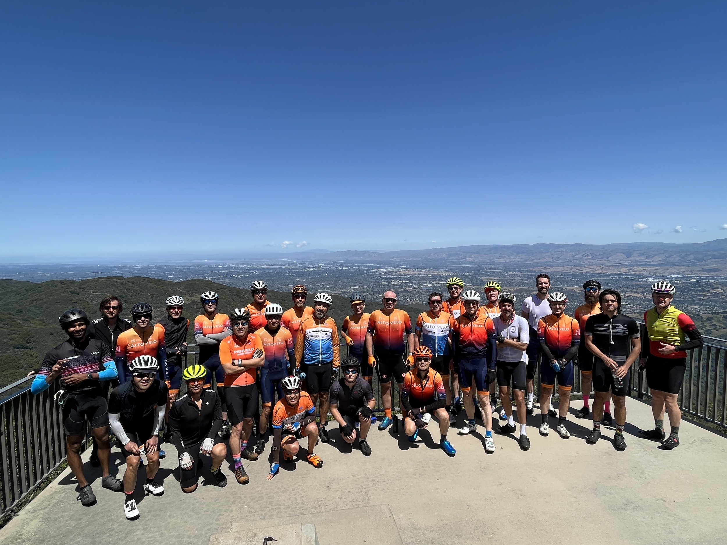
Mt Umunhum, June 2021

Bike Hut, July 2021

Native Sons Rd, April 2022

Christmas Coffee Ride, December 2022